Ingest (Geophys)
About this feature
The Geophysics Ingest Wizard reads SEG-Y sub-bottom profiler sections, generates PNG preview images, and links each section to its corresponding survey trackline. Sections are viewable in the Review Map alongside the interpreted SSDM vector layers.
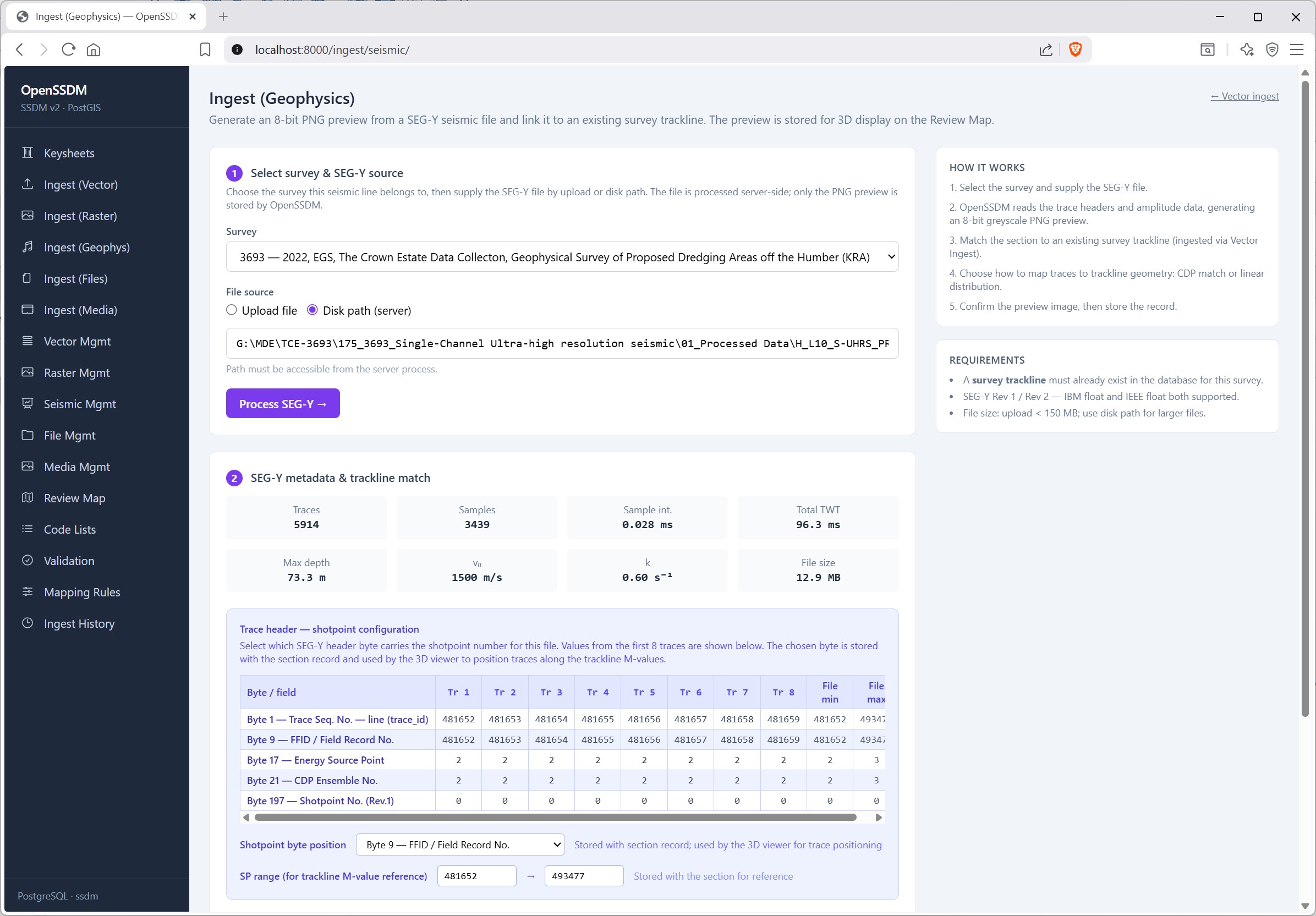
The Ingest (Geophysics) wizard registers single-channel SEG-Y for a chosen survey_id and server-side file path (or upload).
A SEG-Y scan reads binary headers and traces, returning trace and sample counts, sample interval, two-way time span, and file size, and lists per-trace header bytes for verification.
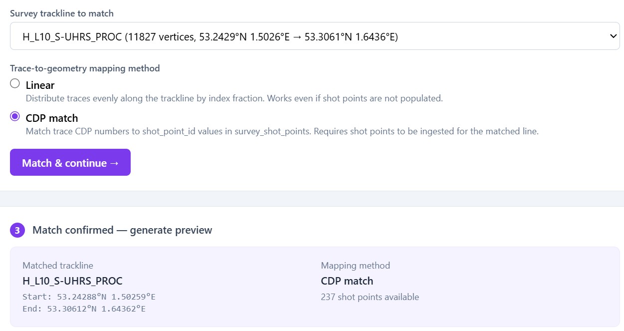
CDP match pairs each trace's header value with survey_shot_points.shot_point_id on the same line, so traces sit at real shot positions along the trackline. Linear ignores shot points and spaces traces evenly along the line by trace number.
Tracklines and shot points are loaded via the vector ingest wizard into survey_tracklines and survey_shot_points; the seismic wizard only reads them.
SEG-Y attachment is by reference: the file stays on disk; seismic_section_inventory stores survey_id, trackline_id, mapping method, SEG-Y path, and preview PNG—so the map can tie the section to that line without duplicating line geometry from the SEG-Y
OpenSSDM uses segyio to open the SEG-Y file, read all traces into a 2D float array (traces × samples), and optionally downsample very long/deep lines for preview. It applies a symmetric amplitude clip from percentiles of the data, normalises amplitudes to 0–255, transposes so depth is vertical and trace number horizontal, then PIL builds an 8-bit greyscale PNG in memory. No separate file is written until the wizard saves the PNG to disk.
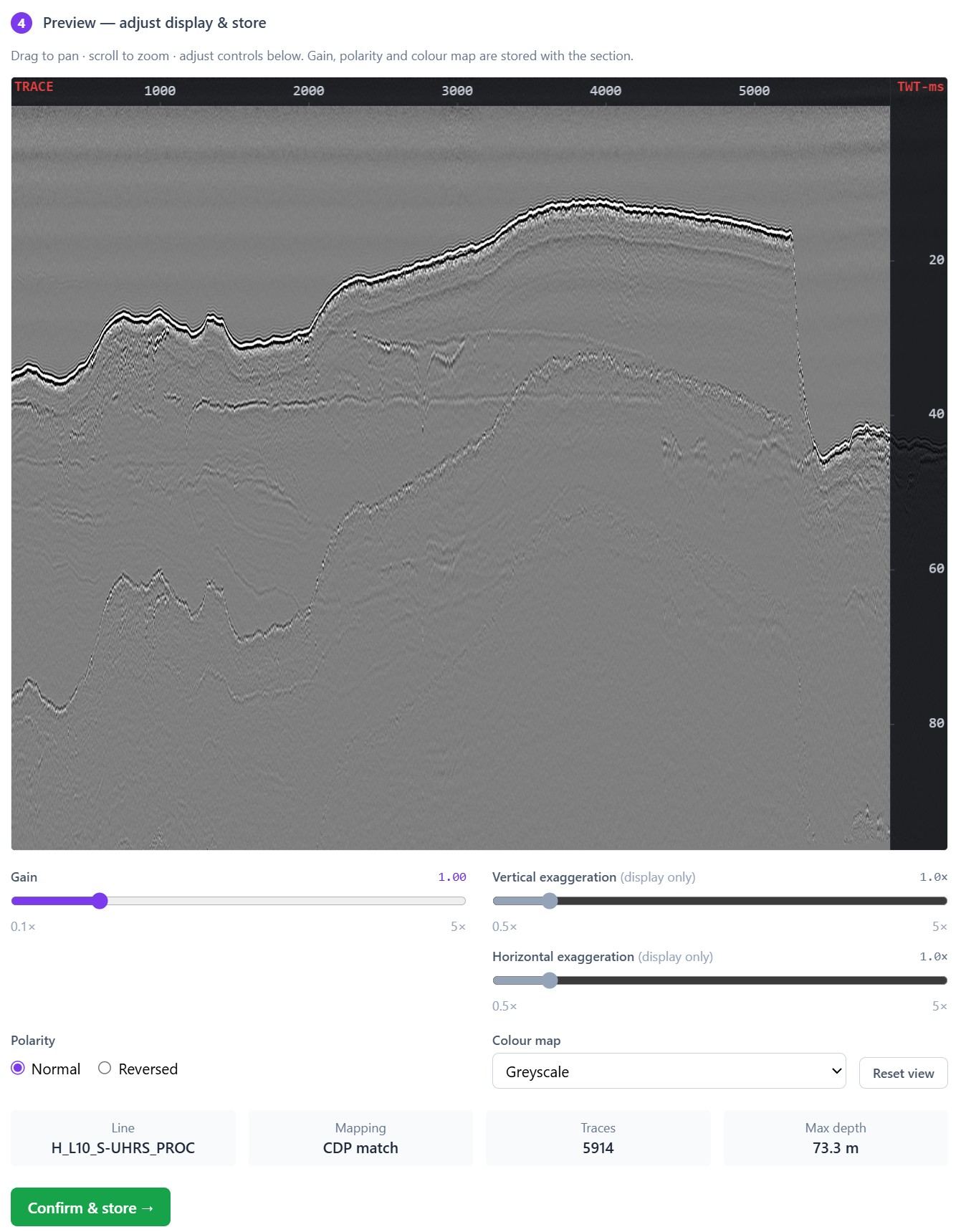
OpenSSDM provides a convenient way to check SEG-Y deliverables through an interactive 2D preview: the operator can pan and zoom the section, adjust gain and polarity (normal or reversed), choose a colour map, and set vertical and horizontal exaggeration for on-screen interpretation—then confirm and store the section; gain, polarity, and colour map are persisted for the Review Map, while exaggeration is only for the preview window.
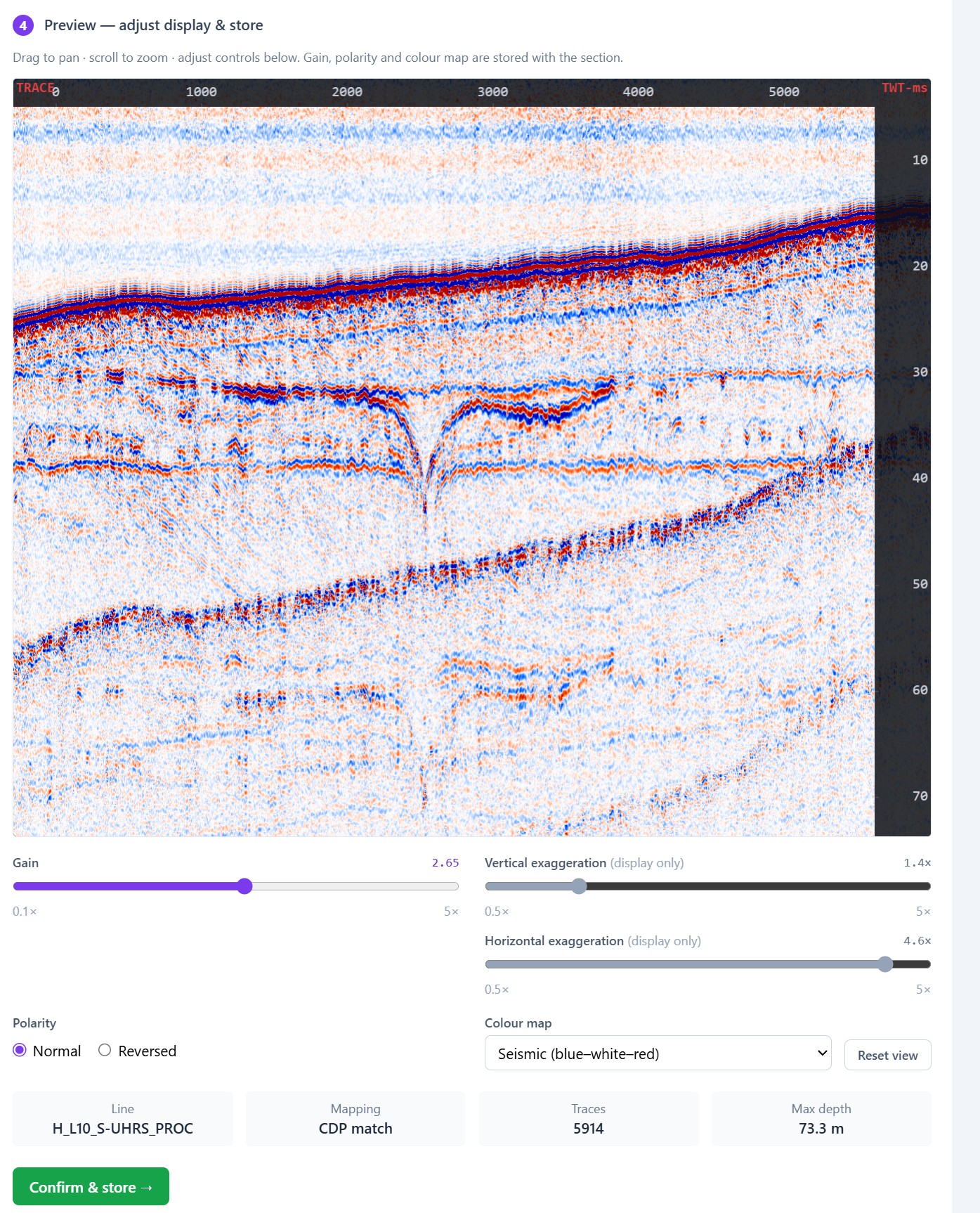
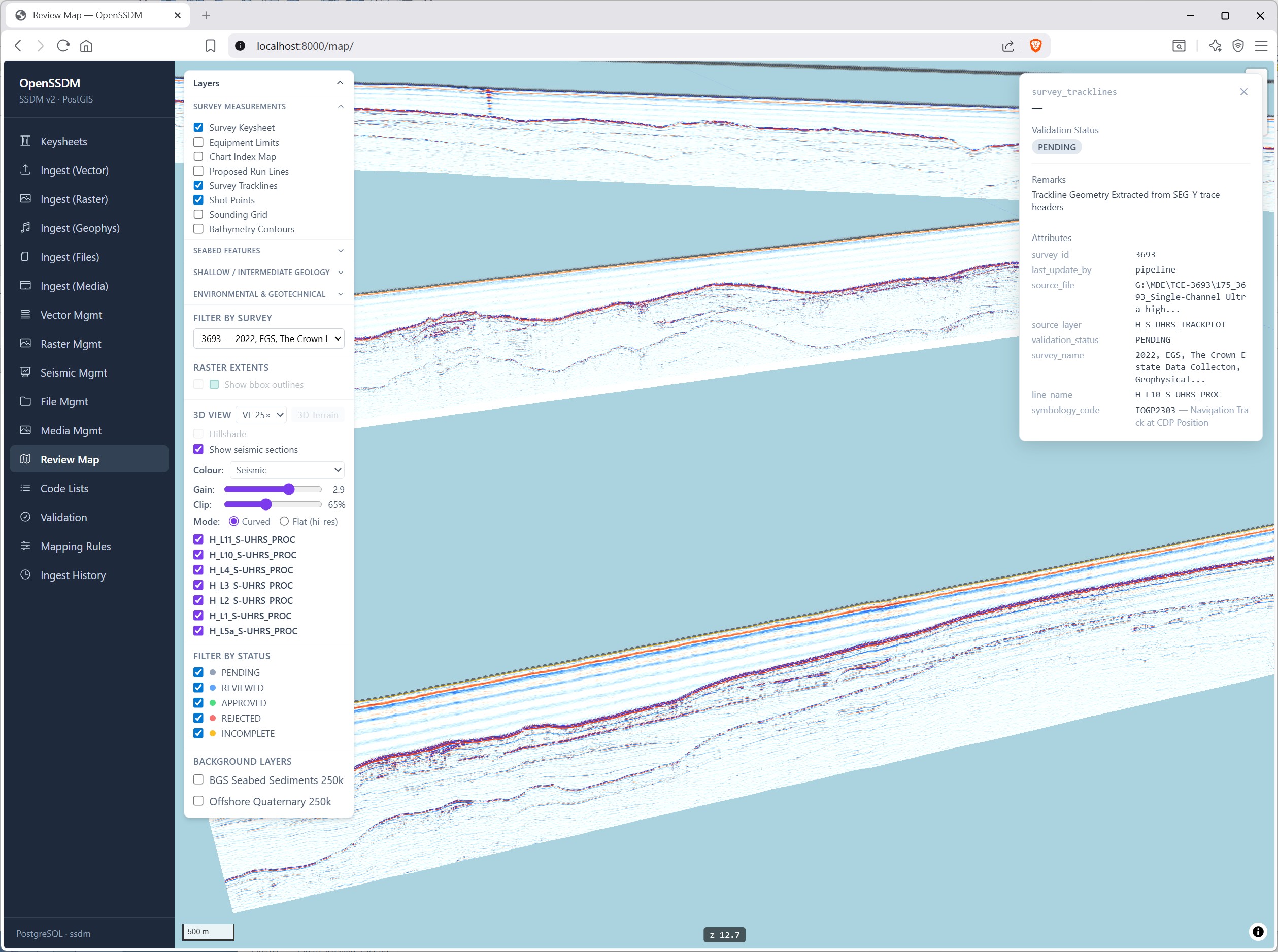
Ingested SEG-Y previews can be viewed together with SSDM vectors—tracklines, shot points, contours, and other survey layers in the Review Map —so navigation, line–trace tie-in, and shot-point consistency can be checked in map context. Crossing lines can be compared visually where sections overlap (a practical mis-tie sense-check.) OpenSSDM does not replace a full interpretation package with automated mis-tie analysis. For full SEG-Y interpretation readers should investigate OpendTect, from dGB Earth Sciences, a widely used open-source (GPLv3+) 2D/3D seismic interpretation environment with strong SEG-Y support. See opendtect.org and dGB — OpendTect.